| METHODOLOGY |
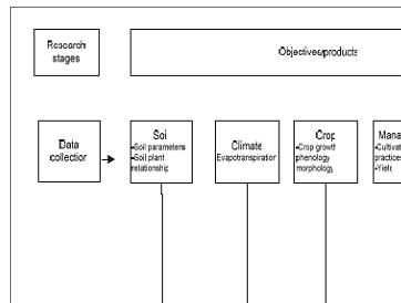
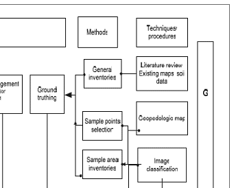
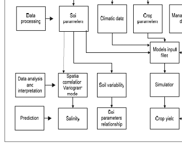
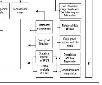
| This study was intended to assess the crop yield of the area with different degree of salinity in relation to soil fertility in both feature and spatial- space. To achieve the aim of the study, the area was chosen where the problems related to the objective of the study exist, and also has support of local authority. Land Development Department (LDD) and ITC jointly work to mitigate the problem of land degradation in few selected areas in Thailand. Since the study area has land degradation problem and falls within the joint project, it was chosen for this research expecting local support. The methods, considering the aim of the study were performed in three stages: pre-fieldwork, fieldwork and post fieldwork. The methodological approach of the overall research work is given in figure 1. |
|
| Figure 1 : Overall methodology |
|
|
Development of Methodologies for
Land Degradation Assessment Applied to
Land Use Planning in Thailand |
|
|