| ESTIMATION WITH THE CURVE NUMBER METHOD |
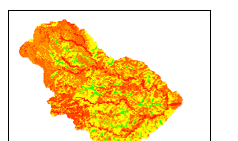
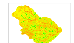
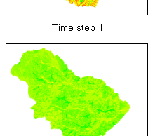
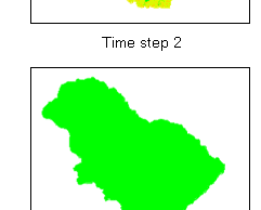
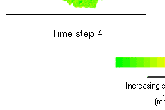
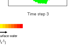
| The second approach involved the use of the curve number method of estimating excess precipitation in PCRaster. It considers an initial abstraction that incorporates all losses before surface runoff occurs. This initial abstraction was determined based on the soil and land use/cover characteristics of the watershed as discussed in section 5.4.2, through the use of tabulated curve number values (USDA, 1986) account for antecedent soil moisture conditions. In addition to this, the approach also considers the retention of water in the watershed over a period of a rainfall event. This accounts for an increase in the amount of water available for runoff due to the accumulation of water that is initially abstracted. These attributes allowed for the simulation of the runoff process in the watershed as it could occur on the ground for each time step. The resulting maps with information on the amount of water available for surface runoff in each cell for each time step of 30 minutes are presented in figure. |
|
| Figure 1 : Spatial and temporal distribution of surface water (time step= 30min) |
|
| References |
 USDA, 1986. Urban Hydrology for Small Watersheds, Natural Resources Conservation Service, Washington D.C. http://www.geog.ucsb.edu/~luc/geog-112/tr55.pdf USDA, 1986. Urban Hydrology for Small Watersheds, Natural Resources Conservation Service, Washington D.C. http://www.geog.ucsb.edu/~luc/geog-112/tr55.pdf |
|
|
|
Development of Methodologies for
Land Degradation Assessment Applied to
Land Use Planning in Thailand |
|
|