| MODELLING RUNOFF USING EMPIRICAL APPROACH |
| Estimation using the Index method |
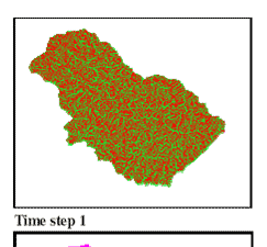
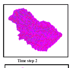
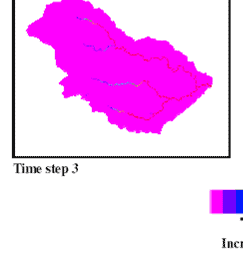
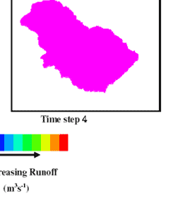
| A simple script with very few PCRaster operators was employed to simulate runoff in this case. The infiltration values introduced via the soil map had no scientific basis making the approach entirely empirical based. This approach has some advantages because of its simplicity, its minimal data requirements and its capability of providing reasonable estimates of runoff rates at different locations in a catchment. Some output maps showing the results of this modelling approach and rainfall data used are presented in figures. |
|
| Figure 1 : Results of the Index Method, time steps showing a period of 30min |
|
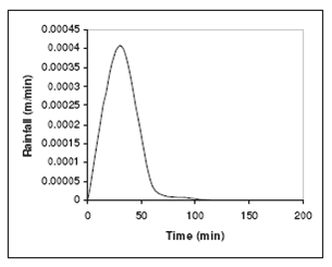 |
| Figure 2 : Rainfall data used for all modelling approaches |
|