| COMPARISON BETWEEN ANG KHANG AND WANG CHIN (WITH RESPECT TO WEIGHTS OF EVIDENCE MODELING USING MORPHOMETRIC PARAMETERS) |
| Although the original objective could not be met because of the different availability of data, and different Lithological units, some DEM derived factors could be used to compare the two study areas. The DEM for the Wang Chin area was generated from the ASTER image using band 3. Having generated the DEM, the Slope, Aspect and Flow Accumulation were derived and a script was run to establish the weights of these three factors with the occurrence of landslides. The resultant weights were then tabulated and compared to the weights of the similar factors in Ang Khang. |
| The weights that are bolded (Table 1) are the positive weights of the classes in the factor maps under investigation with respect to the occurrence of landslides. |
| Parameter |
Ang Khang |
Wang Chin |
| Slope |
WFINAL |
WFINAL |
| 0 - 6.5 degrees |
-1.5936 |
-1.9420 |
| 6.5 - 12.5 degrees |
-0.8178 |
0.4454 |
| 12.5 - 22.5 degrees |
-0.0088 |
0.6509 |
| 22.5 - 45 degrees |
0.3977 |
0.4525 |
| >45 degrees |
-0.9819 |
0.3176 |
| Aspect |
|
| North |
-1.2193 |
-0.9283 |
| North East |
-2.3085 |
-0.4892 |
| East |
-1.4877 |
-0.6175 |
| South East |
0.0809 |
-0.1734 |
| South |
0.6474 |
0.5132 |
| South West |
0.8550 |
0.8592 |
| West |
0.6012 |
-0.1190 |
| North West |
-0.1287 |
0.2019 |
|
| The results presented in Table 1 were applied , with respect to slope gradient, in Ang Khang slopes with a gradient between 22.5 and 45 degrees indicate the highest vulnerability to landslides. This was also seen when the landslide map of Wang Chin was overlaid on the slope gradient map, the result indicated slope instability as low as 5 degrees. The other possibility is that whereas in Ang Khang there seems to be no influence of lineaments on slope stability, landslides in Wang Chin might be influenced by the presence of lineaments. Lineaments are lines of weakness which adversely affect the slope stability of any area in which they are located. However since the relationship between lineaments and the occurrence of landslides in Wang Chin was not investigated in this study, a concrete conclusion can not be drawn with regards to their influence on the occurrence of landslides in the area. |
| Whereas in Ang Khang slopes with a gradient between 22.5 � 45 degrees indicate the highest positive weight, In Wang Chin slopes with a gradient 12.5 � 45 degrees indicate the highest positive weight. Also the weights of the slope gradient map of Wang Chin are relatively higher than those of Ang Khang. Since a positive weight indicates a positive correlation with the occurrence of landslides in an area, then a higher positive value indicates a higher correlation. Therefore it can be concluded that with respect to landslides, slopes seem to play a higher role in the occurrence of landslides in Wang Chin than in Ang Khang. |
| With respect to Aspect, the slope direction which indicates the highest susceptibility to landslides is the South West direction with similar weights in both areas. In this implies that in both watersheds, the South West facing slopes are more prone to landslides than the other slopes. This could be due to the fact that since both districts are located within a similar local climate in Northern Thailand (about 350 km from each other), and are orientated towards the sun in a comparable way. As a result they are influenced by similar climatic conditions thereby showing similar tendencies towards susceptibility to landslides. |
| Ang Khang |
Wang Chin |
| Class |
WFINAL |
Class |
WFINAL |
| 1 - 3 |
-1.3133 |
1- 5 |
0.2200 |
| 3 - 6 |
0.5660 |
5 - 22 |
0.1800 |
| 6 - 16 |
0.7858 |
22 - 100 |
-0.410 |
| 16 - 15500 |
1.0826 |
100 - 1943311 |
-2.812 |
| > 15500 |
1.3758 |
|
|
|
| A number of conclusions can be drawn with respect to the water accumulation on slope in the Ang Khang and Wang Chin catchments as indicated in Table 2. |
| Whereas in Ang Khang the classification of the Flow Accumulation map was not a good one (indicated by the fact that 4 out of 5 classes had positive weights), whereas the results from Wang Chin indicate that the classification was better. In Ang Khang, flow accumulation is influenced by the presence of Karts formations and sink holes as a result of the presence of limestone in the area. Since limestone is more pervious than Shale, ground water flow is inevitably improved in Ang Khang. |
| On the contrary, in Wang Chin, there seems to be no indication of Limestone and presence of Karst formations or sink holes. Flow accumulation classes between 1 � 22 indicate a good correlation with the occurrence of landslides while the higher classes indicate negative higher values. The morphometric parameters from both areas are really different and if we were to use those from one area in another there would be a problem. This is typical of soils derived from Shale which are clayey in nature and therefore impervious thus reducing ground water flow and accumulation. This is in agreement with (Way 1973) who observed that Shale related soils are prone to landslides because they are impervious and so absorption of water on their part, increases their weight thus increasing their instability. |
| Conclusions |
| The use of the Gumbel Extreme value method in Analysis if rainfall data yielded good results for Ang Khang but not for Wang Chin. This is because Wang Chin had a very small data set (8 years) while Ang Khang had a fairly good amount of rainfall data (6 years).. Therefore the return period in this area cannot be relied upon. With respect to Ang Khang, the data set was of 16 years and so the results are fairly good. However in all it can be noted that prediction of the return periods gives us the range within a rainfall amount is to be expected. |
Satellite Imagery, such as ASTER which was used in this study, can be used to map landslides. However better results are obtained when they are combined with aerial photo interpretation. The Maximum Likelihood Supervised classification algorithm with intensity normalisation provided the best results in comparison with the other selected algorithms. The best band combination, with respect to this study was that which included bands 2, 3N (both from the VNIR region of the spectrum) and 4 from the (SWIR region).
The results indicate that the use of a SWIR band with VNIR band in digital image improves the results from the classification. This is because bands in the SWIR of the spectrum make use of the short waves which are vital for high temperature detection (ERSDAC 2005). This is because landslides modify the spectral properties of vegetated slopes and weathered rock surfaces, exposing bright soils and bare rock surfaces. Bare rock surfaces would thus have higher reflectance than vegetated surfaces thus the unvegetated scarps can be clearly identified and classified. The scars left behind have a higher reflectance especially if they are not revegetated since its bare soil. As a result the unvegetated scars can easily be recognized by virtue of a higher reflectance. This therefore results in an improvement on there reflectance characteristics of the features on the image under investigation(Lillesand, Kiefer et al. 2004).
|
|
 |
|
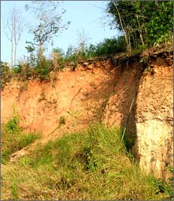
As the study area in northern Thailand is in a tropical environment, most of the new landslides are quickly covered by vegetation. From photo interpretation it was not clear whether they were stable, dormant or stabilised. (Cruden and Varnes 1996) suggest that within regions, standard criteria can be developed to help in distinguishing between different landslides. These criteria could be used to describe the growth of vegetation on the landslide scars. But with the lack of a historical landslide database to compare with and establish possible dates of occurrence of most of the landslides that were recognised in the aerial photos of Wang Chin a simplified nomenclature was adopted. Field work was not possible as the landslide areas were not accessible. |
| Landsliding is a complex process that involves the interaction of different factors such as terrain topography, land cover, climate, etc. In particular, rainfall induced shallow landslides take place in Northern Thailand affecting many areas thus the identification of slope instability indicators is necessary. |
| The use of factors such as topography, soil, geology, and vegetation is important in landslide susceptibility analysis and could provide a quick and cheap analysis (Turner and Schuster 1996). These factors were available and used in landslide susceptibility mapping in Ang Khang. |
| The landslide conditioning factors identified in Ang Khang included rock types of Shales, Sandstones and Conglomerates, slopes with a gradient range between 22.5 to 45 degrees combined with Slightly Gravelly Clay Loam soils. All these factors play an important role in the occurrence of landslides in Ang Khang. |
| The model which made use of active and dormant landslides as the landslide evidence map in predicting future landslide occurrence yielded better results (with respect to this study) than using only active landslides or all available landslides in the area. This is based on the fact that about 90% of the active landslides in Ang Khang could be explained by 40% of the map with the highest susceptibility scores. Concerning the prediction rate, the model predicted that 84% of the landslides occur in the class which is highly susceptible to landslides, 14.1% in the class which is moderately susceptible and 1.9% of the landslides in the class which is less susceptible to landslides. |
| As to the areas that are prone to landslides, the Eastern part (running from North to South) is the Ang Khang area which indicated the highest vulnerability to the occurrence of landslides with a South West Slope Aspect |
| References |
 Cruden, D. M. and D. J. Varnes (1996). Landslide types and Processes. Landslides:Investigation and Mitigation. A. K. Turner and R. L. Schuster. Washington, D.C, Transportation Research Board National Research Council. Special Report 247: 36 - 75. Cruden, D. M. and D. J. Varnes (1996). Landslide types and Processes. Landslides:Investigation and Mitigation. A. K. Turner and R. L. Schuster. Washington, D.C, Transportation Research Board National Research Council. Special Report 247: 36 - 75. |
| ERSDAC (2005). ASTER: Advanced Spaceborne Thermal Emission and Reflection Radiometer.ERSDAC: 15. |
| Lillesand, M. T., W. R. Kiefer, et al. (2004). Remote Sensing and Image Interpretation. New York, John Wiley & Sons. |
| Turner, A. K. and R. L. Schuster, Eds. (1996). Landslides:Investigation and Mitigation, Transportation Research Board. Special Report 247. Washington, D.C, National Academy Press. |
| Way, D. G. (1973). Terrain Analysis: A Guide to Site Selection Using Aerial Photographic Interpretation. Stroudsburg,Pennsylvania,USA, Dowden, Hutchinson & Ross, Inc. |
|


