
|
||||||||||||||||||
|
Permanent Forest Application Program |
||||||||||||||||||
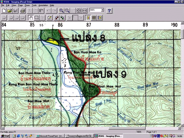
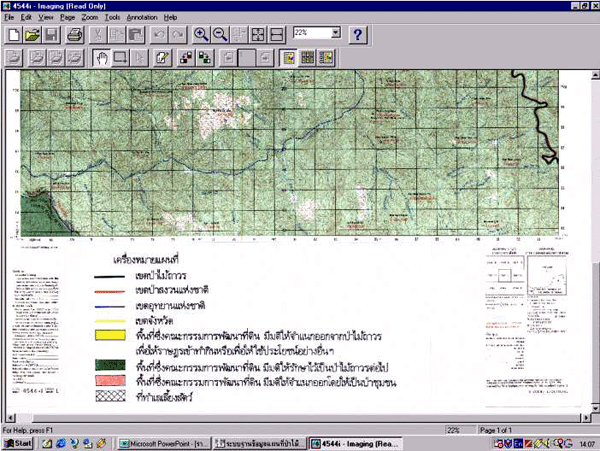
| Permanent Forestry is a GIS application program in Microsoft Windows to display permanent forest area of 30 million rai (4.8 million ha.) of the whole country in 1: 50,000 scale that was kept as persevation area in 65 provinces, in Visual basic language. It can be categorized into permanent forest, national preservation and national park areas, including legal agricultural land. The program can display permanent forest area on topo-map sheet and their attribute tables. | ||||||||||||||||||
|
||||||||||||||||||
|
||||||||||||||||||
 |
||||||||||||||||||
|
||||||||||||||||||
|
||||||||||||||||||
 |
||||||||||||||||||
|
||||||||||||||||||
|
||||||||||||||||||
|
||||||||||||||||||
|
||||||||||||||||||
|
Land
Development Department
|
||||||||||||||||||
|
2003
/ 61 Phaholyothin Rd. Chatuchk Bangkok
10900 Thailand
|
||||||||||||||||||
|
Call
: 66 - 2579 - 4132 - 40 or 66 - 2941
2131 www.ldd.go.th or
www.gisservice.net
|
||||||||||||||||||
|
Copyright
2002 Land Development
Department
|
||||||||||||||||||