 |
|||||
|
|||||
|
Economic crops Zoning (AgZone version 1.0) |
|||||
| AgZone is the application program for agro-ecological zoning follow FAO land evaluation (FAO, 1976). Parameters used in the program are soils, land use / land cover, land units, forest areas, irrigation areas, moisture availability, LUT and distance from factory in specific crops (15 economic crops). The highly suitable zone (Z - I) is from highly suitable to moderately suitable soils with in irrigated areas, exclude forests, urban areas and < 1 km from roads. | |||||
|
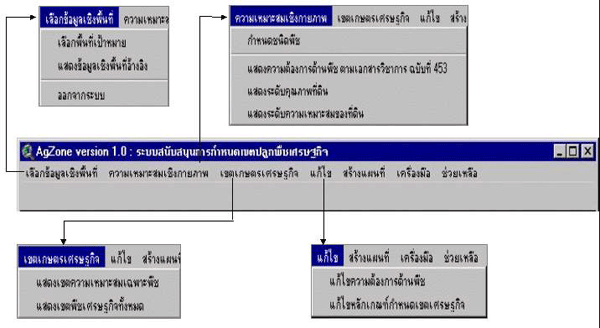
Picture : Main menu
|
|||||
 |
|||||
 |
|||||
|
|||||
|
|||||
|
|||||
 |
|||||
|
|||||
 |
|||||
|
|||||
 |
|||||
|
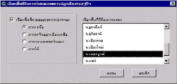
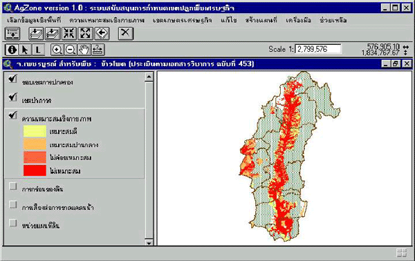
Picture : Soil suitability
|
|||||
 |
|||||
|
|||||
|
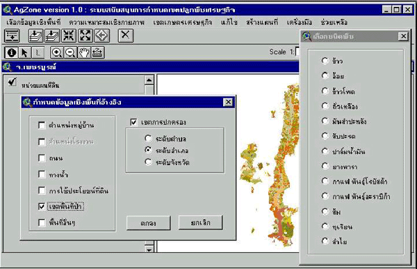
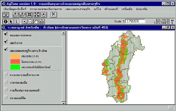
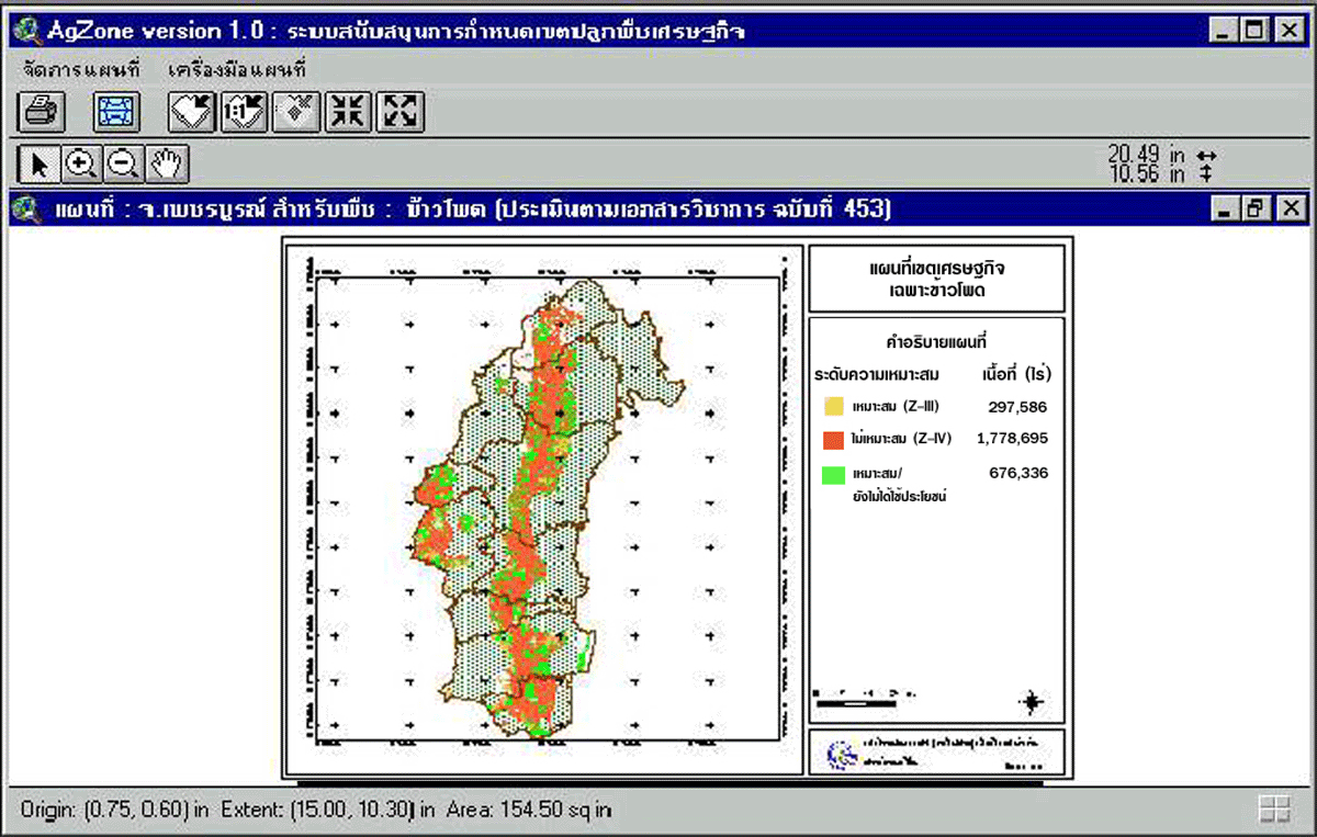
Picture : AgZone - economic
zone for specific crop
|
|||||
 |
|||||
|
|||||
|
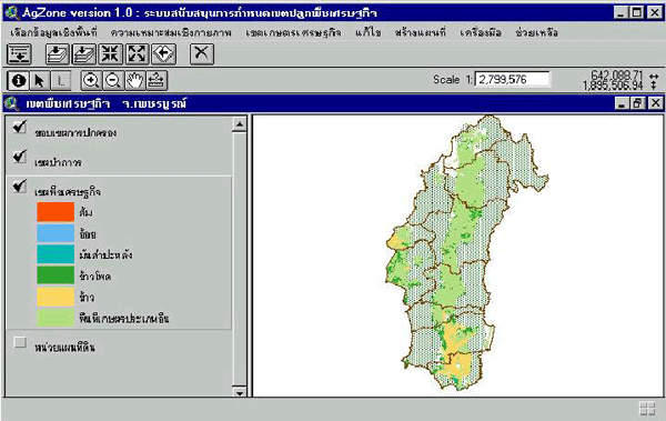
Picture : AgZone - economic
zone for overall
|
|||||
 |
|||||
|
|||||
|
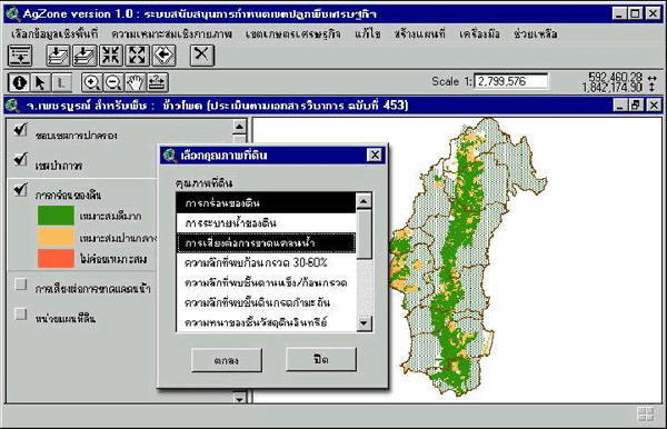
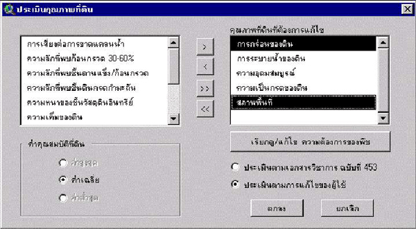
Picture : Physical suitability
evaluation by user 's requirement
|
|||||
 |
|||||
|
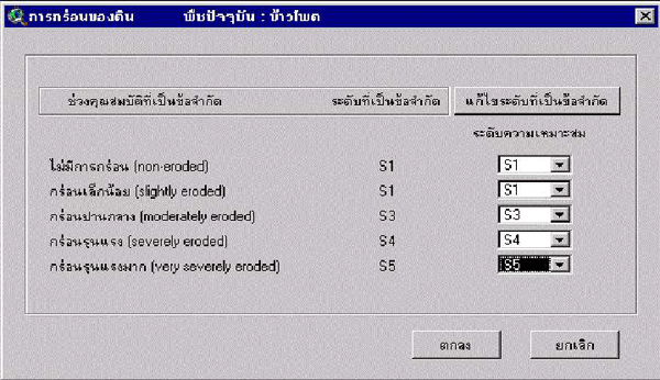
Picture : Changing
of crop requirement (e.g.) soil erosion
|
|||||
 |
|||||
|
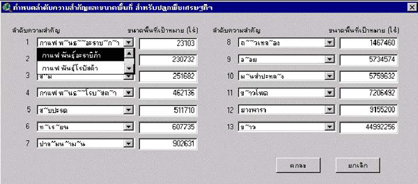
Picture : Crop
priority and size of area for economic crop
|
|||||
 |
|||||
|
|||||
|
Picture : Save
by user defined
|
|||||
 |
|||||
|
|||||
|
Picture : Print
out map
|
|||||
 |
|||||
|
Land
Development Department
|
|||||
|
2003
/ 61 Phaholyothin Rd. Chatuchk Bangkok
10900 Thailand
|
|||||
|
Call
: 66 - 2579 - 4132 - 40 or 66 - 2941
2131 www.ldd.go.th or
www.gisservice.net
|
|||||
|
Copyright
2002 Land Development
Department
|
|||||